Showing posts with label biking. Show all posts

Sunday, May 1, 2016

Cycling Mt. Constitution, Orca Island

Craig and I finally checked off riding our bikes to the top of Mt. Constitution, Orcas Island. It was a beautiful ride with a nice mid-point stop with lots of restaurants and cafes to fuel up before the big climb. Once we reached the summit, the views that greeted us lived up to their reputation. The scene was an expansive sea of blue dotted with heavily vegetated green islands and backed by a ridge of white mountain peaks on the horizon.  As usual, the San Juan Islands did not disappoint and I look forward to a return trip!

Nesting birds at the ferry terminal

Wood carving outside of the Historical Museum.

View from the top of Mt. Constitution. Mt. Baker is the white peak in the background.

We made it!

Tide going out on the ride back to the ferry.

Departing Orcas Island for Seattle on the ferry.

Sunset on Mt. Baker from the ferry.

Sunday, April 10, 2016

Afternoon on Vashon Island

One of my favorite things about living in West Seattle is the easy access to Vashon Island. It's a piece of rural paradise just west of Seattle that is only accessible by ferry. Fortunately for us, we're about 1.5 miles from the ferry station so we can easily hop on our bikes and be on the island within 30-40 minutes. Every time I visit, I find something different. With distilleries, wineries, coffee roasters, strawberry festivals, cideries, a lighthouse, and beautiful small farm landscapes backed by volcano views, it's hard not to find something to love.

After a long, rainy winter, spring is finally starting to arrive in Seattle, allowing the perfect opportunity for an afternoon bike ride on the island. Ah, how I've missed this place!

Ferrying to Vashon

 Biking on the rural roads

Chocolate cupcakes at Snapdragon

East Indian pancakes, pupusas, and local ciders at Snapdragon! 

 More views along the ride.

Tying up the steads on the ferry ride home.

Beautiful spring day in Seattle

Me with Mt. Rainier in the background

Looking down from the 2nd deck of the ferry

West Seattle ferry station

Sunday, April 3, 2016

Emerald City Bike Ride

For a few hours this weekend, two Seattle freeways were open to bikes only! As a part of the first time-offered Emerald City Bike Ride, 7,000 riders gathered to ride the 21-mile urban loop over the new SR-520 floating bridge, the I-5 Express Lane, and around Seattle. 

Bikers at the turn-around point of the ride on the floating bridge.

Biker gang on the SF-520 floating bridge

Lower deck of the I-5 Expressway 

The view from the I-5 Expressway is much easier to appreciate from a bike.

Just the early morning downtown commute.

Sunday, May 10, 2015

Cycling Hurricane Ridge

Cycling Hurricane Ridge may not have been the most well planned out biking trip we've done, but it was an adventure for sure. Because of a crunch for time, Craig, Stephen, and I decided to bike on Sunday. However, we all went a Seattle Mariners baseball game on Friday night and, after a few drinks, convinced ourselves that starting out Saturday morning would be the better option.

Hurricane Ridge is on the Olympic Peninsula, meaning that it's across the Sound from us in Seattle. The fastest way to get there is by taking a ferry across the water. With three of us traveling in two separate cars, this proved to be logistically more difficult than anticipated. 

On the morning of the ride, Craig and I realized we had no food in the house for lunch so we picked up sandwiches at a nearby sandwich shop that opens at 6am. This place has been my lunch savior on multiple hiking trips. We made it to the ferry terminal around 9:15a to find that it was packed with other travelers. Realizing that we might not all make it on the boat, we phoned Stephen and found that he was lined up a row behind us for the ferry. Being this close, I was pretty confident we were all going to make it across.

Fortunately, I am not a betting woman and didn't place money on these odds because he was just short of getting on our boat! Doh! Once crossing, Craig and I waited for an hour on the other side of the Sound. After Stephen finally caught up with us, we high-tailed it to the mountains so wouldn't loose more time from the ride.

As fate would have it, right as we approached the bridge crossing Hood Canal, another large body of water we had to transverse, the road barrier dropped and the bridge opened up to let a ship pass. I looked around for a nearby boat that was holding up our schedule and found a distant crane being pulled by a tug. It was so far away and seemed to be barely moving! We were held up here for at least 30 minutes. Everyone got out of their cars to catch the local entertainment provided by the sea animals. In the short span of time we were there, we saw loads of pigeon guillemots, jellyfish, porpoises, and seals.

Waiting for a ship to be towed through the crossing.

The two ships we're waiting on.

After crossing the bridge, we drove another 1.5 hours and finally arrived at the park's visitor center, our starting point. Without much delay, we suited up and were on our way! Immediately after leaving the parking lot, we started climbing...and it never stopped once until we reached the summit ~5500 feet above us. 

I'll be honest and say that it was one of my least favorite bike climbs I've done. Granted, I was in a lot of pain for almost all of it with a combination of back problems, legs cramping from eating too much before starting out, and being tired from the night before. Aside from the few (gorgeous) lookout areas, it also wasn't a very scenic or dynamic ride. We were mostly in the trees and the climb was brutal at times with little visual reward for motivation.

As we were inching along up the hill, a car passed us going the opposite direction and I suddenly heard what sounded to be my name being violently screamed out a window. I turned back and saw that the vehicle has stopped and the screaming continued. Someone got out of the vehicle and threw their arms in the air saying, "Erica, what are you doing here?!" I then realized it was on of our best friends, Chris, who was just coming back from a hiking trip off of the same road! It was totally random, especially considering we have been trying to coordinate our schedules for a backpacking trip for months now. So random and hilarious!

Climbing

One of the fantastic view points along the way

tunnels

A quickly eroding cliff face and my bike.

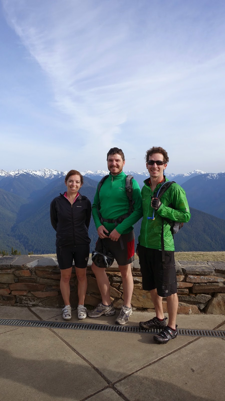
The crew on the way up.

After hours of huffing, puffing, and my complaining, we finally made it to the top! I've never spent much time in the Olympics mostly because of the difficulty getting to them. Seeing them up close at Hurricane Ridge made me eager to to summit some of the peaks beckoning from a distance. 

We spent a few minutes at the top taking in the views, but were quickly getting chilled by the evening air. Knowing we had a quick ~45 minute, cold descent ahead of us, we didn't dally for long. I'm happy to say that the ride down made up for the misery on the way up. It was fast with steep pitches for most of the ride; I would guess we picked up speeds of 45mph. Although I was still having terrible back pain and was so cold my legs were trembling (not something you want to experiencing bombing down a mountainside on a bike), it was super fun and gave us the downhill adrenaline we've been looking for. 

We did, however, lose poor Stephen on the way down. He got a slow flat along the way, but we were gone too quickly to hear him yelling for us. Fortunately, someone saw him fixing his tire and just took him to the bottom of the hill to save him the trouble.

Stephen near the top of Hurricane Ridge.

Almost to the top!

Deer in a meadow fronting the Olympic mountains.

We made it! Now for the bomb down.

Profile of our ride.

I never would have said it on the way up, but the downhill portion made me think I might try this ride again someday. Of a higher priority now is climbing some of those Olympic mountains we saw from the top of Hurricane Ridge!

Sunday, April 19, 2015

Cycling Mt. St. Helens

Continuing with our trend of biking on roads closed for the winter/early spring season, Craig and I jumped at the chance to cycle Spirit Highway, the road leading to Mt. St. Helens, before it opened to cars. Round trip, the route was about 70 miles, with only a 20 mile section closed to motorized vehicles. There was no snow along the road this time of the year, so I assume the road closure was due to having a lack of funding to support staff in the winter at the Johnston Ridge Observatory.

The ride, although very long and tiring, was awesome! Once we entered the blast zone, an approximate 19 mile radius of obliteration surrounding the mountain's north side, we had fantastic, near constant views of Mt. St. Helens. It was eerie to see the devastation while the snow-capped mountain beamed silently, yet proudly in the distance as if still basking in her underestimated force. Being on a bike allowed us hours taking in this scene while imagining the horror of pyroclastic flows traveling at speeds up to 670 miles per hour, flattening everything in its path.

Entering the blast zone

Mt. St. Helens comes into view

Even with the top gone, that is one big mountain!

On the final stretch to the top. The mountains behind me were tree covered prior to the 1980 eruption.

We finally reached the top and were stunned to find that even with such beautiful weather and an accessible trail head several miles away, there was no on else there! I've been to the observatory before during normal operating hours and, as with most National Parks and Monuments, it's typically packed with people. The experience of being there without crowds was enough to ensure that I'll never go back during the open season; the encounter is just not comparable. It was so incredibly peaceful to be alone with this colossal peak towering overhead and surrounded by a desert landscape that is only beginning to recover from the eruption 25 years later. The only sounds to be heard were the constant whistle of distant winds blowing up and over the summit. It was also the only peak covered in snow, casting a radiance that demanded attention. 

We had the whole observatory to ourselves!

Mt St Helens and her devestation

close up with a new bulge forming

No one here!

I lay down to get some rest before the descent.

Posing with the mountain

It was hard to descend because we kept stopping to take pictures. As it got to be later in the afternoon, the lighting continuously made the landscape more and more photogenic. Once we finally put away the cameras, it was a fun ride, but with more uphill than I recalled.

I'd really like to do this ride again, but only ride the 20 miles without cars and turn it into a sunset trip. The colors were so lovely in late afternoon so I can only imagine the pallet that would open up as the sun sets!

More views on the way down

More views on the way down

More views on the way down.

More views on the way down.

 Profile of the ride.

Tuesday, September 2, 2014

Mountain biking at Lake Tahoe

Below are a few scenes from our fantastic bike ride along the Flume Trail, located on the east side of Lake Tahoe. The trail was 14 miles at 7000-8000 ft of elevation, which I definitely was feeling during the steep ascent at the beginning of the ride; it's tough coming from sea level! The ride started with a cruise through meadows and aspens, which eventually transitioned into a steep climb up Lake Tahoe's flanks to finally reveal the blue beauty on the other side. Looking down at the massive body of water, it was sometimes difficult to convince yourself that it was a lake and not the sea. The winds were howling on this day so even though it was Labor Day, there were very few people on the water, which probably strengthened this illusion. 

Ms. Tahoe and me

Beach for ants

Craig hoisting up Gary F. for a view

Taking in the sights

Lake Tahoe making it hard to keep my eyes on the road

Nearing the end of the ride